Registration رقم التسجيل : N86CE
تاريخ الحادث: 24 يانبر 2006 الموافق 25 ذو الحجة 1426هجرية
24 JAN 2006
(25/12/1426هجرية)
الضحايا: 4 أشخاص
تحطم طائرة سسنا من نوع Cessna 560 Citation قبيل هبوطها و أشتعالها باللهب ومقتل جميع من عليها وكان على متنها 4 قتلى هم ركاب وطاقم الطائرة

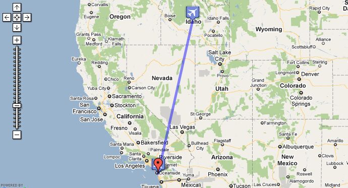
Citation N86CE departed Sun Valley (SUN) at 05:50 MST on a flight to Carlsbad (CLD). The airplane climbed to its assigned cruising altitude of FL380, which was reached at about 06:06 MST. The descend for Carlsbad was started an hour later, at 06:06 PST. Air traffic control cleared the flightcrew for the ILS approach to runway 24, which was 4,897 feet long. The flightcrew then reported that they had the runway in sight, cancelled their IFR clearance, and executed a VFR approach in VFR conditions to the airport. The reported winds favored a landing toward the east, onto the opposite runway (runway 6). During the approach, after a query from the first officer, the captain indicated to the first officer that he was going to "...land to the east," consistent with the reported winds. However, the final approach and subsequent landing were made to runway 24, which produced a six-knot tailwind. During the approach sequence the captain maintained an airspeed that was approximately 30 knots higher than the correct airspeed for the aircraft's weight, resulting in the aircraft touching down about 1,500 feet further down the runway than normal, and much faster than normal. The captain then delayed the initiation of a go-around until the first officer asked if they were going around. Although the aircraft lifted off the runway surface prior to departing the paved overrun during the delayed go-around it impacted a localizer antenna platform, whose highest non-frangible structure was located approximately 304 feet past the end of the runway, and approximately two feet lower than the terrain at the departure end of the runway. The aircraft continued airborne as it flew over downsloping terrain for about 400 more feet before colliding with the terrain and a commercial storage building that was located at an elevation approximately 80 feet lower than the terrain at the end of the runway. The localizer antenna platform was located outside of the designated runway safety area, and met all applicable FAA siting requirements.